
Are these “off the shelf” drones or built to spec? That sounds incredible capabilityThe drone does not only carry a thermal camera. It has a thermal, wide angle and zoom. The UAV operator can switch from one camera to the next at the push of a button. The zoom camera is very powerful; we have been able to see the anal tush on a roe doe at up to 2km away. The level of detail the OP is after is easily achievable using drones.
You are using an out of date browser. It may not display this or other websites correctly.
You should upgrade or use an alternative browser.
You should upgrade or use an alternative browser.
Professionals: Deer Count Surveys - Thermal Drone Usage
- Thread starter JMikeyH
- Start date
That sounds like a superb set up, and exactly what is needed.I’ve been involved in annual deer census at landscape scales using drones for the last few years. We count but also build a very accurate understanding of herd structure; species, sex and age. Mostly fallow and roe in heavily wooded river valleys.
The drone does not only carry a thermal camera. It has a thermal, wide angle and zoom. The UAV operator can switch from one camera to the next at the push of a button. The zoom camera is very powerful; we have been able to see the anal tush on a roe doe at up to 2km away. The level of detail the OP is after is easily achievable using drones.
As you point out, you need more than just a thermal. When I said ‘the technology is not yet there’, I meant specifically thermal technology. If you have a multi-function drone, then anything is possible. Though you do need an operator who knows what they’re doing, and you need a systematic survey protocol. All of which it sounds very much like you have.
By contrast, the majority of drone surveys I’ve seen in the last 18 months have been extremely half assed, with someone doing half a morning of fairly unsystematic flying.
On several occasions, I’ve seen thermal drone surveys done in daytime on ground where it was well known the deer only came on at night. Obviously these generated completely inaccurate estimates.
Deermanagement
Well-Known Member
If one is just looking at an area of 1000 acres, someone who already knows the ground should be able to assess density well enough from all the signs available.
Having had a walk on the weekend around only part of a woodland block that usually see a rise in number once the leaf is off the trees and the surrounding shoots get into full swing, I can ascertain that numbers are not as high as the last couple of years, Roe and Muntjac the same, the odd Fallow as usual, but Sika are likely down as much as 75%.
I will see what happens in the next couple of weeks and Sika numbers will be determined once again. Other local areas have seen the same so far, and the reasons are possibly known as to why a “Sika migration”, does not seem to have happened as yet.
The use of thermal drones over large open areas I’m sure can be very accurate and useful but dense woodland, especially conifer will have little chance of identifying the smaller deer’s population and even less so than experienced guys looking at the signs on the ground.
reeves_dama
Active Member
I’ve seen thermal drone surveys done in daytime on ground where it was well known the deer only came on at night. Obviously these generated completely inaccurate estimates.
That statement is true if say you were doing a census in July with lots of cover around, but most reputable drone operators will do the main of their counts from around December - March when to be honest, unless you have nothing but Fur trees for cover, there are generally few places they can hide. So very irrelevant on the day/night aspect at correct time of year depending on your ground.
Main issue I've seen behind accurate counts not being carried out are people trying to get a slice of the market (and grant funding) by using low end drones as you pointed out that have no where near the output of the equipment someone like BH is using for example, not entirely knowing how to use them, then doing the surveys at silly times of year.
Either way though, no one can argue the system is much more accurate than the good old count with the Bino's and hand held thermal! Does make you wonder what technology is going to be like in another 10 years though!
Woodsy
Well-Known Member
Are these “off the shelf” drones or built to spec? That sounds incredible capability
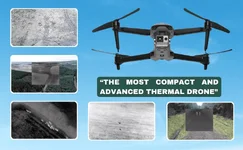
The drone is off the shelf - DJI Matrice 350 RTK / H20T Combo.
Polar Lynx
Well-Known Member
Side note .... using budget drone quite often but then mainly for 'where are the boar, etc'. Much easier when snow, of course, but especially boar move in groups (4-7) and follow same trail which is easy to see all year.
Attachments


Not cheap!The drone is off the shelf - DJI Matrice 350 RTK / H20T Combo.

DJI Matrice 350 RTK Drone Only & H30T Payload with Worry-Free Basic Co
This cutting-edge Matrice 350 RTK introduces a host of advanced features, including an all-new video transmission system, enhanced control interface, upgraded battery system, robust safety features, and extensive payload and expansion options. Fully powered to forge ahead, the Matrice 350 RTK...
 dji-retail.co.uk
many are now. FLS do a lot of Drone survey work - and not just for deer managementI do wounder why the big organisations are not using drones instead of Helicopters. Surly it is cheaper and the benefits must be they can use them in and around or towns and lowlands were counts have very rarely been done. Unless they don't really want to know how many deer we have because a million sounds good.
NatureScot have that info, at least for those recorded in annual deer returns. However many farms and estates culling small numbers aren't registered.A bit OT, but is there any sort of register of deer numbers shot in say, England, Scotland and Wales each year?
Ken.
I suspect you would get these via a simple request, if not then an FOI will get this as it is public data. They are certainly supply freely to our DMG
kenbro
Well-Known Member
Thank you, Sir.NatureScot have that info, at least for those recorded in annual deer returns. However many farms and estates culling small numbers aren't registered.
I suspect you would get these via a simple request, if not then an FOI will get this as it is public data. They are certainly supply freely to our DMG
Ken.
David Barker
Well-Known Member
A bit OT, but is there any sort of register of deer numbers shot in say, England, Scotland and Wales each year?
Ken.
This will be presumably on there own grounds. I feel they the government departments should be getting better figures from our lower grounds instead on continually using millions to count every blade of grass on the highland deer estates. Sorry rant over lol.many are now. FLS do a lot of Drone survey work - and not just for deer management
yes on their own grounds - North, East, West, South and Central. Not sure why FLS would survey out with their own landsThis will be presumably on there own grounds. I feel they the government departments should be getting better figures from our lower grounds instead on continually using millions to count every blade of grass on the highland deer estates. Sorry rant over lol.
They have done an annual deer survey on the Quantocks for years, always the same day / week of the year, using people who know what they are looking for / counting
This year they used a drone survey on top of the mark 1 eyeball survey. The drone upped the actual number significantly.
This year they used a drone survey on top of the mark 1 eyeball survey. The drone upped the actual number significantly.
Quantock Deer Management and Conservation Group
Quantock Deer Management and Conservation Group exist to help conserve and guide management of deer on the Quantock Hills
www.quantockdeergroup.co.uk
For info.
David Barker
Well-Known Member
I think it is important to know what is on your ground and sometimes more important to know what is happening on surrounding grounds as this is w3ere your infill will come from.yes on their own grounds - North, East, West, South and Central. Not sure why FLS would survey out with their own lands
Similar threads
- Replies
- 36
- Views
- 2K
- Replies
- 3
- Views
- 489
- Replies
- 29
- Views
- 6K
